
In brief
- The State is taking another 127,863 square metres for the Caransebeș-Timișoara-Arad railway and is paying 4,699,105.39 lei. There are 362 entries of privately owned land, in twelve localities in the counties of Caraș-Severin, Timiș and Arad. Adding the publicly owned land taken over through Annexes no. 3 and no. 4, the site called „suplimentar”, the additional one, comes to 175,608 square metres, that is 17.6 hectares.
- Half the owners receive less than 1,000 lei. The median compensation is 901.34 lei, 55 entries take less than 100 lei, and the smallest amount on the list is 2.29 lei. At the other end, the top ten entries add up to 2,439,790.02 lei, that is 51.9% of all the money.
- A fifth of the compensation goes back to the State and to the town halls. Eight entries belong to the State-owned railway companies and are worth 661,278.79 lei, while 42 are entered in the name of communes or of the town of Arad, as private domain, and are worth 311,801.51 lei. The note „proprietar neidentificat”, unidentified owner, appears on 47 entries, which together come to 694,791.13 lei.
Published: Official Gazette of Romania, Part I, no. 810 of 24 September 2026, pages 2-23
In force from: 24 September 2026, the date of publication, because Government decisions are not subject to the three-day period laid down for laws and ordinances
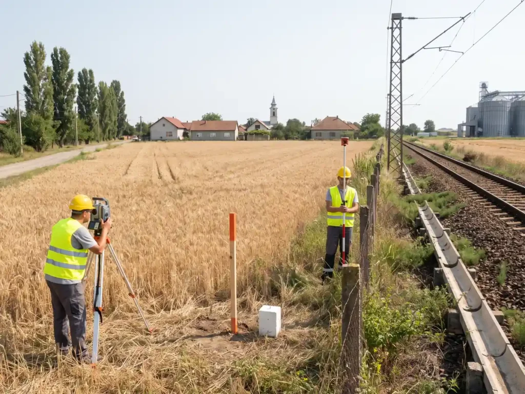
On 18 September 2026 the Government adopted a decision that widens the expropriation corridor of the Caransebeș-Timișoara-Arad railway upgrade, and the text appeared on 24 September 2026 in the Official Gazette of Romania. The mechanism is the one applied a day earlier to the additional site at Azuga and Bușteni: the Government approves a new site, puts the private properties standing on it on a list, sets an amount for each of them and becomes the owner within a few weeks. The legal basis is Article 11(6) of Law no. 255/2010, the provision that allows the procedure to be reopened when the site of the works changes after the feasibility study has been revised or after the technical design has been finalised. Article 1 of the decision says expressly where the change comes from: the additional site is the one resulting „conform variantei finale a studiului de fezabilitate”, in line with the final version of the feasibility study.
The Caransebeș-Timișoara-Arad line is 162 kilometres long and forms part of the southern branch of pan-European corridor IV. The technical and economic indicators of the works were approved by Government Decision no. 412/2021, and the expropriator is the Romanian State, represented by the Ministry of Transport and Infrastructure, through the National Railway Company CFR. The twelve localities affected now are Caransebeș, Păltiniș, Constantin Daicoviciu and Sacu in Caraș-Severin county, Găvojdia, Dudeștii Noi, Sânandrei and Orțișoara in Timiș county, Vinga, Șagu, Arad and Vladimirescu in Arad county.
The amount is written in Article 3 rounded to thousands of lei: 4,700. Adding up the 362 individual values in Annex no. 2 gives 4,699,105.39 lei, exactly the total printed at the end of the list, so the rounding in the body of the decision leaves a surplus of 894.61 lei. The money comes from the State budget, through the budget of the Ministry of Transport and Infrastructure, but not from a line of its own spending: the chapter is 84.01 „Transporturi”, transport, the title is 56 „Proiecte cu finanțare din fonduri externe nerambursabile (FEN) postaderare”, projects financed from post-accession external grants, and the budget article is 56.48, the programmes financed from the European Regional Development Fund for the 2021-2027 financial framework.
Of the 4,699,105.39 lei, 3,534,286.57 go on land and 1,164,818.82 on buildings, that is almost a quarter of the money for 586 square metres of gross floor area and 510 metres of buildings measured in length, mostly fences. By county, most entries are in Arad, 149 of them, with 55,616 square metres and 2,068,123.38 lei; Timiș follows, with 144 entries, 33,393 square metres and 1,472,017.06 lei, then Caraș-Severin, with 69 entries, 38,854 square metres and 1,158,964.95 lei.
The topographic plan of the site, that is Annex no. 1, was not published. A footnote says that the map is provided on request by the National Railway Company CFR, the „imposibilitatea publicării”, the impossibility of publishing it, being put down to „impedimente de natură tehnico-redacțională”, obstacles of a technical and editorial nature. Article 5 nevertheless obliges the expropriator to display the plans at the offices of the local councils and on its own website.
What it changes in practice
From 24 September 2026, the 362 properties in Annex no. 2 are under expropriation. The National Railway Company CFR issues the expropriation decisions, deposits the amounts in the names of the owners and registers the corridor in the land book, Romania’s land register. An owner who accepts the amount collects it; one who does not accept it can challenge it in court, without that stopping the works, because the transfer of ownership does not depend on the owner’s agreement.
The money does not leave straight away. Article 3(2) says that the Ministry of Transport and Infrastructure transfers the amounts into a treasury account opened in the name of the railway company „în termen de cel mult 30 de zile de la data solicitării acestora”, within no more than 30 days of their being requested. The period therefore runs from the expropriator’s request, and the decision sets no deadline for submitting that request and no deadline for actually paying the owner.
Annexes no. 3 and no. 4 produce a different kind of effect. Through them, 13,051 square metres of land in the public property of the State pass into the corridor, in 20 entries, and 34,694 square metres of land in the public property of the administrative-territorial units, in 86 entries. Nothing is paid here: these are transfers inside public property. The largest part of the State land is administered by the National Agency for Land Reclamation and by the water basin administrations, that is, the old canals and dykes that cross the line, while of the town halls’ land 65 entries with 24,385 square metres are communal roads.
For 47 entries, the State does not know whom it is paying. The footnote to Annex no. 2 says that the names of the owners „vor fi identificate ulterior”, will be identified later, without setting a deadline and without providing for any form of public search. The 47 entries mean 19,823 square metres and 694,791.13 lei, that is 14.8% of the compensation, sums that stay frozen in the account until someone turns up to claim them.
What has changed compared with the previous situation
This decision is not the first widening of this line’s corridor. On 30 December 2025 the Government had adopted Decision no. 1.168/2025, published in Official Gazette of Romania no. 1221 of 31 December 2025, also for an „additional site” of the Caransebeș-Timișoara-Arad upgrade, and also on the basis of Article 5(1) and (11) and Article 11(6) of Law no. 255/2010. That decision covered another seven localities in Timiș county, Lugoj, Coșteiu, Belinț, Topolovățu Mare, Recaș, Remetea Mare and Ghiroda, with compensation of 3,860 thousand lei. Put end to end, the two decisions add 8.56 million lei of additional compensation on the same line in nine months.
The preamble of the present decision does not mention the one from December 2025 and does not refer to any act that would have approved the original corridor. A reader who wants to find out by how much the site has grown compared with the form first approved has nowhere to start: the only act cited is the one with the technical and economic indicators, Government Decision no. 412/2021.
The comparison with the week’s other additional site shows how differently land is priced. At Azuga and Bușteni, 134,890 square metres were valued at 23,087,988.44 lei, that is 171.17 lei per square metre. Here, an almost identical area, 127,863 square metres, costs 4,699,105.39 lei, that is 36.75 lei per square metre, 4.7 times less. The difference lies in what is being crossed: there, yards and buildings within the built-up area of two mountain resorts, here, arable land on the Banat plain.
Advantages and disadvantages
What it improves
- All three categories of land, private, public property of the State and public property of the town halls, are settled by a single act, so the corridor can be registered in one go, without waiting for other decisions.
- The totals close down to the last ban: the sum of the 362 individual amounts of compensation gives exactly the value printed at the end of Annex no. 2, and the areas in Annexes no. 3 and no. 4 also match their own totals.
- The money is already allocated in the budget, on a line identified down to the article, not promised out of some future amending budget.
- The act certifies, in the footnote to Annex no. 2, that no places of worship, monuments or historic sites were identified on the site, that is, none of the situations in which the expropriation would have required a law rather than a Government decision.
- For the 47 entries with no known owner the money is nevertheless provided for, so anyone who proves their right later has a source from which to be paid.
What remains a problem
- Half the list receives token amounts. The median of the list is 901.34 lei, and 55 entries take less than 100 lei, with the whole apparatus of notification, valuation, decision and land registration set in motion for each of them.
- The price per square metre varies 240-fold within the same act, from 1.38 lei for the watercourse beds at Sacu to 331.38 lei for the arable land within the built-up area of Sânandrei, without any criterion appearing in the published text.
- The valuation reports on which the amounts rest are not published, so an owner cannot compare their own compensation with the rule by which it was calculated.
- The plan of the site, Annex no. 1, is missing from the Official Gazette of Romania (Monitorul Oficial), and anyone who wants to see where the corridor runs has to ask the railway company for the map or go to the town hall.
- This is the second widening of the same corridor in nine months, and some of the owners are entering for a second time a procedure they believed was over.
Practical advice
- Check whether your property is on the list. Annex no. 2 is read in the official PDF edition, attached at the end of this article, on pages 4 to 18. Search by the name of the locality, then by cadastral number or by field block and parcel, not by name, because 47 entries are listed with no owner.
- If you find your land but the owner column says „proprietar neidentificat”, unidentified owner, take your title deeds to the town hall and to the cadastre office. The amount is already provided for in the annex and it is yours, but nobody is looking for you.
- Ask for the plan of the site. The plan was not published, but Article 5 obliges the expropriator to display it at the offices of the local council and on its own website, and the footnote says that it is provided on request by the National Railway Company CFR.
- Compare the area expropriated with the total area in your deeds, both are in the table. If what is left of the parcel is an unusable strip, ask for full expropriation during the administrative procedure, before you sign your acceptance of the amount.
- Do not sign your acceptance of the compensation if you do not agree with it. Challenging the amount in court does not stop the works and does not make you lose your right to the money already deposited, but a written acceptance closes the discussion.
- If you have a building or a fence on the land, check the building columns in the table. Fences appear in linear metres and are paid at 230, 280 or 400 lei per metre, depending on the entry, while buildings appear in square metres of gross floor area.
- Keep a copy of the page of the Official Gazette of Romania on which your entry appears. It is the only public document that attests the amount estimated by the expropriator and it serves as your starting point in a challenge.
Frequently asked questions
When do I lose my ownership?
How much do I get for a square metre?
What does „proprietar neidentificat” mean?
My commune is losing communal roads. Am I compensated?
Why can I not find the map of the site in the Official Gazette of Romania?
What happens if I do not agree with the amount?
Errors and inconsistencies in the published text
- Annex no. 2, entries 249 and 278: the same cadastral number for two different properties, in the same commune. Entry 249 puts cadastral number 311063 in the name of Filip Viorica, field block 44, parcel 255/38, out of a property of 39,627 square metres, with 43 square metres expropriated and 186.34 lei. Entry 278 puts the same cadastral number 311063 in the name of S.C. Fox Impex S.R.L., field block 360, parcel 2756/36, out of a property of 36,000 square metres, with 6 square metres expropriated and 45.88 lei. Both are in the commune of Șagu, Arad county, and within the same administrative-territorial unit a cadastral number identifies a single property. The cadastral number is the item on which the expropriation decision is issued and the land book entry is made, so one of the two entries cannot be carried out as it is written.
- The same description of the owner leads, in two annexes, to two opposite regimes. In Annex no. 2, entries 93 to 96 in the commune of Găvojdia carry in the owner column, on the same line, both the name of the commune as holder of the private domain and the note of an unidentified owner; they receive compensation, 1,277.38 lei in total for 447 square metres. In Annex no. 4, entries 4 and 6 at Constantin Daicoviciu, entry 20 at Sacu and entry 23 at Găvojdia are described in the same way, the commune plus the note of an unidentified owner, but they are placed in the public domain and receive nothing, although they come to 513 square metres. The two descriptions are mutually exclusive, because an asset in the public domain of the commune has an identified owner, and the act shows neither the criterion by which the entries were divided between the two annexes nor what happens to those in Annex no. 4 if the owner turns up. The footnote promising later identification is written only under Annex no. 2 and is not repeated under Annex no. 4.
- The footnote to Annex no. 2: the list taken from Article 7(4) of Law no. 33/1994 leaves out cemeteries. The footnote certifies that „nu au fost identificate terenuri care fac parte din categoria prevăzută la art. 7 alin. (4) din Legea nr. 33/1994 […], respectiv: lăcașuri de cult, monumente, ansambluri și situri istorice, alte așezăminte de valoare națională deosebită ori localități urbane sau rurale în întregime”, that no land was identified falling within the category laid down by Article 7(4) of Law no. 33/1994, namely places of worship, monuments, historic ensembles and sites, other establishments of exceptional national value or entire urban or rural localities. The text of the law lists „lăcașuri de cult, monumente, ansambluri și situri istorice, cimitire, alte așezăminte de valoare națională deosebită ori localități urbane sau rurale în întregime”, with cemeteries among them. The category is defined by reference and narrowed immediately afterwards, and the certification does not establish whether cemeteries were checked. What is at stake is not formal: for assets in that category, public utility is declared by law, not by Government decision.
Editorial analysis
The observation that does not show up when you read the act from start to finish appears only when you set it beside the Official Gazette of Romania of 31 December 2025. There, Government Decision no. 1.168/2025 approved another „additional site” on the same Caransebeș-Timișoara-Arad line, for Lugoj, Coșteiu, Belinț, Topolovățu Mare, Recaș, Remetea Mare and Ghiroda, with 3,860 thousand lei, on the basis of the same three provisions of Law no. 255/2010. In nine months, the same works have produced two decisions completing the corridor and 8.56 million lei of additional compensation. Neither of them mentions the other and neither refers to the decision that approved the original corridor. Anyone who wants to know today how much land the project has gathered in total, and with what money, has to add up three acts for themselves, with nothing linking them.
The second observation comes out of sorting the list by price. The grid has almost fifty combinations of locality, position in relation to the village and land use category, and within each of them the rate repeats identically from one entry to the next, which points to a valuation made by classes, not by property. Two results stand out. At Șagu, for arable land outside the built-up area, sixteen entries receive 4.33 lei per square metre, while six entries receive 7.65 lei, 77% more; the break falls exactly at the move from the field blocks towards the village to field block 360, the one against the boundary of the town of Arad, where the rate is also 7.65. At Sânandrei, arable land within the built-up area takes 331.38 lei per square metre, while yards and buildings in the same built-up area take 152.94, so land for ploughing is paid 2.17 times more than the land under a building, in the same commune. The explanation may exist in the valuation reports, but the reports are not published, and it cannot be deduced from the act.
The third observation concerns the relation between the administrative effort and the sums moved. Of the 362 entries, 167 are under 100 square metres and 118 are under 50. The median amount is 901.34 lei, 190 entries take less than 1,000 lei and together add up to 60,154.12 lei, that is 1.3% of the total, while 55 entries take less than 100 lei and add up to 2,157.15 lei, at an average of 39 lei each. The smallest compensation on the list is 2.29 lei. For each of these files a valuation is carried out, a decision is issued, the owner is notified, the cadastral documentation is drawn up and the land book is updated, and the cost of these steps far exceeds the amount paid. At the opposite end, ten entries hold 51.9% of the money, and thirty-six entries, that is 10% of the list, hold 82%.
Finally, the make-up of the beneficiaries deserves saying, because it does not show in any total. Eight entries on the list of private property belong to the State-owned railway companies, the National Railway Company CFR and S.N.T.F.M. CFR Marfă, and are worth 661,278.79 lei, that is 14.1% of the allocation; this is land in their private domain, so the State, through the Ministry of Transport and Infrastructure, pays 661 thousand lei to companies it controls itself, for works of their own. Another 42 entries are in the name of communes or of the town of Arad, as private domain, and are worth 311,801.51 lei. Together, 973,080.30 lei, that is 20.7% of the compensation, stays within the public sphere, while through Annexes no. 3 and no. 4 the same institutions give up 47,745 square metres free of charge. Natural persons hold 212 entries and 2,326,852.92 lei, that is 49.5%, less than half of the sum the act calls compensation. What does come out well in this act is the arithmetic: all six columns with totals in Annex no. 2 close to the last ban, as do the areas in Annexes no. 3 and no. 4, and the references to Law no. 255/2010 and to Government Decision no. 53/2011 lead where they should.
What should be changed
- Every decision on an additional site should cite the earlier ones for the same works. A line in the preamble referring to Government Decision no. 1.168/2025 and to the decision on the original corridor would show at a glance how much the project has grown and would make the total spent on expropriation verifiable.
- The valuation grid should be published together with the annex. As long as it stays unpublished, an owner in Șagu cannot find out why the neighbour across the road gets 7.65 lei per square metre while he gets 4.33, and has nothing to challenge apart from his own amount.
- A simplified procedure should be provided for entries below a value threshold. Fifty-five entries in this act are worth 2,157 lei between them, less than it costs to put their files together; a flat-rate payment through a single act would spare both the administration and the people.
- The 30-day period should be tied to the publication of the decision, not to the expropriator’s request. Today the owner loses the property on a date that can be calculated from the law, while the State starts counting its 30 days from an act it issues whenever it chooses.
- The note „proprietar neidentificat” should come with a search deadline and with a publication of those entries by name. There are 47 entries and 694,791.13 lei; as things stand, the money sits frozen without anyone being obliged to look for the owner within a set period.
- The plan of the site should be published, at least as a file attached to the electronic edition. A plan that does not fit the printed page fits a PDF, and „impedimente de natură tehnico-redacțională” no longer explain anything when the Official Gazette of Romania is read on a screen anyway.
Original text of the legal act
The text below is reproduced in Romanian, the official form of publication.
The full text, as published in the Official Gazette of Romania
Official Gazette of Romania no. 810 of 24 September 2026 32 pages PDF, 208 KB the act starts on page 2
Open the official PDFDownload the PDF
The viewer is not shown on small screens. Use the buttons above to open or download the file.
This article is for informational purposes only and does not constitute legal advice. For specific situations, consult a licensed attorney or tax advisor.