
In brief
- The Government is expropriating two privately owned plots in the commune of Bod, Brașov County, for the upgrading of the Brașov-Sighișoara railway line to 160 km/h.
- Total compensation comes to 481,692.90 lei for 3,489 square metres. The two owners are companies, not private individuals.
- A further 125 square metres from the public domain of the State and 12,351 square metres from the public domain of the commune of Bod and of Brașov County are being transferred, with no compensation.
Published: Official Gazette of Romania (Monitorul Oficial) no. 702 of 25 August 2026
In force from: 25 August 2026
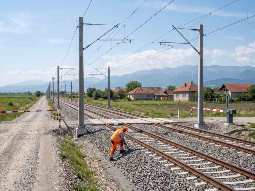
The upgrading of the railway between Brașov and Sighișoara needs one more strip of land at Bod, and the decision published now says exactly who loses it and how much they are paid for it: two companies, 3,489 square metres, 481,692.90 lei. Government Decision no. 650/2026, published in Official Gazette of Romania no. 702 of 25 August 2026, approves the additional site and launches the expropriation. The works are part of the railway programme that the Government placed, this summer, on a new contractual footing with the National Railway Company CFR.
The project is called „Rehabilitation of the Brașov-Simeria railway line, a component of the Rhine-Danube Corridor, for running at a maximum speed of 160 km/h, the Brașov-Sighișoara section, subsections 1. Brașov-Apața and 3. Cața-Sighișoara”. Its technical and economic indicators had been approved by Government Decision no. 340/2018 and re-approved by Government Decision no. 372/2025.
The additional site follows from the final version of the feasibility study, that is from the measurements taken once the project had been worked out in detail. The expropriating authority is the Romanian State, through the Ministry of Transport and Infrastructure, and the operations are carried out through the National Railway Company CFR.
What it changes in practice
The first effect is the approval of the additional site, within the boundaries of the commune of Bod in Brașov County, in line with the final version of the feasibility study.
The second effect is the expropriation itself. Annex no. 2 contains two positions: 867 square metres belonging to S.C. Vectra Service S.R.L., in the village of Bod, compensated with 147,650.10 lei, and 2,622 square metres belonging to Societatea Națională de Radiocomunicații S.A. București, in Colonia Bod, compensated with 334,042.80 lei.
The third effect is budgetary. The total sum estimated by the expropriating authority is 481.7 thousand lei, that is exactly 481,692.90 lei, and is allocated from the state budget, through the budget of the Ministry of Transport and Infrastructure, under the state budget law for 2026, Law no. 43/2026.
The fourth effect has to do with the source of the financing. The money goes to chapter 84.01 „Transport”, title 56, budget article 56.48, that is programmes financed from the European Regional Development Fund for the 2021-2027 financial framework.
The fifth effect concerns publicly owned land. Annex no. 3 transfers 125 square metres held in the public ownership of the State and administered by CFR, while annex no. 4 covers ten positions from the public domain of the commune of Bod, of the administrative-territorial unit of Brașov and of Brașov County, adding up to 12,351 square metres. These carry no compensation, they are transferred between public bodies.
The sixth effect is the deadline. The sums are transferred by the ministry into a treasury account opened in the name of CFR, within no more than 30 days of the date on which they are requested.
The seventh effect is publicity. The plans of the additional site are displayed at the premises of the local council concerned and on the website of the expropriating authority.
The eighth effect is an important finding recorded in annex no. 2: the cadastral documentation did not identify on the site any places of worship, monuments, historic ensembles or sites, other establishments of exceptional national value or entire settlements, that is none of the categories for which Law no. 33/1994 requires a special procedure.
What has changed compared with the previous situation
The first change is the widening of the corridor. Until now, the expropriation covered the route approved at the outset. The final version of the feasibility study showed that a further area is needed at Bod, and that area now enters the procedure.
The second change concerns the project itself. The indicators approved in 2018 for the Brașov-Sighișoara stretch were re-approved in 2025 on a structure broken down into subsections: 1. Brașov-Apața, 2. Apața-Cața and 3. Cața-Sighișoara. The present decision covers only subsections 1 and 3.
The third change is one of scale. Unlike expropriations on motorways, where the lists run to thousands of positions, here there are only two privately owned properties, both belonging to companies.
On another stretch of railway the list looks nothing like this: the Caransebeș-Timișoara-Arad line takes a further 127,863 square metres across 362 private entries, and 55 owners receive less than 100 lei.
The fourth change is the operational expropriating body. On road works, the company that carries out the procedure is the road company. Here the role falls to the National Railway Company CFR.
What does not change is the legal framework. The procedure remains the one laid down in Law no. 255/2010, with the implementing rules approved by Government Decision no. 53/2011.
Nor does the way the topographic plan is made known change. Annex no. 1, the map of the site, is not published in the Official Gazette of Romania for technical and editorial reasons, but is sent out by CFR to interested parties on request.
Advantages and disadvantages
What it improves
- The list is short and published in full in the ordinary edition, so anyone can check the names, the areas and the sums.
- The individual sums appear explicitly, not merely a total: 147,650.10 lei and 334,042.80 lei.
- The cadastral documentation confirms that there are no places of worship, monuments or historic sites on the land concerned.
- Publicly owned land is transferred between public bodies, at no cost to the budget.
- The upgrading to 160 km/h on the Rhine-Danube Corridor is moving ahead, and expropriation delays are being dealt with one by one rather than by halting the works.
What remains a problem
- The map of the site is not published, and anyone who wants to see it has to ask CFR for it.
- The additional site turns up eight years after the technical and economic indicators were first approved.
- The note in the annex says that further identification details of the owners will be established later, so the documentation is not complete on the date of publication.
- The 30-day deadline runs from the date on which the sums are requested, an internal moment that the owner has no way of following.
- The decision says nothing about how much delay or how much extra cost this additional area brings to the works.
Practical advice
- If you own land in the commune of Bod or in Colonia Bod, check annexes no. 2 and no. 4 in the edition attached to this article. The full list has 13 positions, so it takes a few minutes to read.
- Ask the National Railway Company CFR for the map of the additional site. Annex no. 1 is sent out at the request of interested parties, because it could not be published in the Official Gazette of Romania.
- Check the noticeboard at the premises of the Bod local council as well, where the plans have to be brought to public notice.
- Compare the cadastral number and the land register number in the annex with your own documents. The note in the annex acknowledges that the identification details will be completed later.
- If you are one of the two companies in annex no. 2 and you do not agree with the sum, the challenge procedure is the one in Law no. 255/2010, and the time limits run from the notification of the decision setting the compensation.
- If you are a town hall or a county council, keep an eye on annex no. 4. Areas from the local public domain are transferred without compensation, but with an effect on the inventory.
Frequently asked questions
How many private owners are affected?
How much is being paid?
Where is the land?
Why is more land needed now?
What happens to the land held by the town hall?
Where can I find the map?
From when does the decision apply?
Errors and inconsistencies in the published text
- Annex no. 4, positions 9 and 10: the parcels „HO 12” and „HO 13”. Every other parcel in the act is numbered with the prefix BO, from BO 1 to BO 11, including in annex no. 2 and in annex no. 3. At the last two positions in annex no. 4 the prefix becomes HO, although the column alongside shows the same county, the same administrative-territorial unit and the same locality, Colonia Bod. The correct form is plainly BO 12 and BO 13. The practical consequence is not cosmetic: annex no. 1, the plan on which these parcels are drawn, is not published in the Official Gazette of Romania, so a reader who asks the railway company for the plan will be looking on it for two numbers that are not there.
- Annex no. 4, positions 4 and 5: owner „UAT Brașov”, for land situated in the administrative-territorial unit of Bod. The two strips of road, 17 and 50 square metres out of cadastral number 108746, are entered against the public domain of „UAT Brașov”, while the column „Unitatea administrativ-teritorială” on the same rows says Bod, and the title of the decision limits the whole list to properties „aflate pe raza unității administrativ-teritoriale Bod, județul Brașov”, situated within the administrative-territorial unit of Bod, Brașov County. The same annex uses, at positions 9 and 10, the name „Județul Brașov”, Brașov County, followed by the reference to the public domain, so the two labels are not run together in the text of the act. It stays unclear whether the owner is the municipality of Brașov, in which case the list carries an administrative-territorial unit that the title excludes, or the county after all, in which case the name should have been written as it is at positions 9 and 10.
Editorial analysis
This is the smallest expropriation possible for a work on a European corridor: two parcels, 3,489 square metres, 481,692.90 lei, two owners, both of them companies. That is precisely why the act manages what the large decisions do not: it publishes everything in the ordinary edition of the Official Gazette of Romania, names, areas and individual sums, out in the open. The comparison can be made within the same edition, no. 702 of 25 August 2026, where Government Decision no. 632/2026, for the western bypass of Timișoara, sends its annexes off into a 146 page bis edition. The difference is not one of transparency policy but of volume, and that says something about the limits of printing on paper as an instrument of information.
The figure worth reading closely is not the total but the price per square metre. The 867 square metres taken from S.C. Vectra Service S.R.L. are valued at 147,650.10 lei, that is exactly 170.30 lei per square metre, while the 2,622 square metres taken from Societatea Națională de Radiocomunicații S.A. are valued at 334,042.80 lei, that is exactly 127.40 lei per square metre. Both plots are within the built-up area, both are in the land use category yards and buildings, both lie in the same commune, a few kilometres apart. The difference of a third between the two rates may have a perfectly reasonable valuation explanation, but the decision does not give it and does not say what date the values refer to either. In a list with two positions, where the comparison is made at a glance, the absence of the criterion is more visible than it is in tables with thousands of rows.
The second observation concerns the balance between private and public. The state pays for 3,489 square metres, but takes over without compensation 12,476 square metres from the public domain, 125 from the state through annex no. 3 and 12,351 from the commune of Bod, from Brașov County and from that „UAT Brașov” in annex no. 4. The largest part, 10,452 square metres, is a pasture of the commune outside the built-up area, taken over in full. The transfer costs the state budget nothing, but it removes from the commune’s patrimony an area larger than everything expropriated from private owners, and the decision does not say who updates the inventory of the local public domain after this operation, or within what period.
What remains, finally, is the way the act relates to its own map. The footnote explains that annex no. 1 could not be published because of „impedimente de natură tehnico-redacțională”, technical and editorial impediments, and that it is supplied by the railway company on request. At the same time, Article 5 requires the expropriating authority to display the plans on its own website. In other words, the act acknowledges that the plan can circulate digitally, but does not tie the two obligations together: the reader learns where to ask for the plan, not where to find it already published.
What should be changed
- The exact address of the plan, written into the footnote. Where the footnote sends interested persons to ask for annex no. 1 from the National Railway Company CFR, it ought also to carry the address of the page on which the plan is displayed under Article 5. In practice, anyone who wants to see where the additional site runs would open a file instead of writing a request and waiting for an answer.
- The valuation date and the rate per square metre, entered in annex no. 2. One extra column, with the unit value and the date of the valuation report, would explain by itself why one plot is valued at 170.30 lei per square metre and another at 127.40 lei. In practice, an owner could challenge the method, not merely the final figure.
- The exact total in the operative part, not a rounded one. Article 3(1) allocates „481,7 mii lei”, 481.7 thousand lei, while annex no. 2 adds up to 481,692.90 lei. In practice, anyone comparing the operative part with the annex would get the same figure, and the check on budget execution would no longer start from a rounding difference.
- A deadline for updating the public inventories. The decision transfers 12,351 square metres from the public domain of the administrative-territorial units, including a pasture of 10,452 square metres taken over in full, but does not say how long there is to make the change in their inventories. In practice, it would head off the situation in which the same area appears for years on end both in the commune’s inventory and in that of the railway infrastructure.
- A corrigendum for the parcel prefix and for the name of the owner. Positions 9 and 10 in annex no. 4 have to carry the prefix BO, and positions 4 and 5 have to name the owner the same way it is named in the rest of the table. In practice, the site plan and the published list would use the same numbers, and the 67 square metres of road would have an identifiable owner.
Original text of the legal act
The text below is reproduced in Romanian, the official form of publication.
The full text, as published in the Official Gazette of Romania
Official Gazette of Romania no. 702 of 25 August 2026 16 pages PDF, 159 KB the act starts on page 6
Open the official PDFDownload the PDF
The viewer is not shown on small screens. Use the buttons above to open or download the file.
This article is for informational purposes only and does not constitute legal advice. For specific situations, consult a licensed attorney or tax advisor.